Back A3 road German جاده ای۳ Persian Route A3 (Grande-Bretagne) French כביש A3 (בריטניה) HE A3 (Groot-Brittannië) Dutch A3 road (Great Britain) SIMPLE A3 (Storbritannien) Swedish A3公路 (英國) Chinese
| A3 | ||||
|---|---|---|---|---|
| Route information | ||||
| Length | 72 mi (116 km) | |||
| Major junctions | ||||
| North-east end | City of London 51°30′39″N 0°05′12″W / 51.5108°N 0.0866°W | |||
| South-west end | Portsmouth Harbour 50°47′30″N 1°06′31″W / 50.7918°N 1.1086°W | |||
| Location | ||||
| Country | United Kingdom | |||
| Primary destinations | Kingston upon Thames Guildford Petersfield | |||
| Road network | ||||
| ||||
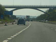
The A3, known as the Portsmouth Road or London Road in sections, is a major road connecting the City of London and Portsmouth passing close to Kingston upon Thames, Guildford, Haslemere and Petersfield. For much of its 67-mile (108 km) length, it is classified as a trunk road and therefore managed by National Highways. Almost all of the road has been built to dual carriageway standards or wider. Apart from bypass sections in London, the road travels in a southwest direction and, after Liss, south-southwest.
Close to its southerly end, motorway traffic is routed via the A3(M), then either the east–west A27 or the Portsmouth-only M275 which has multiple lanes leading off the westbound A27 — for non-motorway traffic, the A3 continues into Portsmouth alongside the A3(M), mostly as a single carriageway in each direction through Waterlooville and adjoining small towns. The other section of single carriageways is through the urban environs of Battersea, Clapham and Stockwell towards the northern end, which has to accommodate bus lanes and parking meter bays.


